Site Information
Siamese Lakes
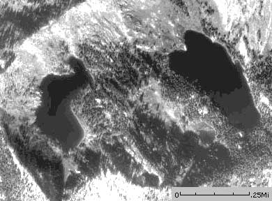 Classification: Lake
Latitude: 46.8555°
Longitude: -114.9135°
Elevation: 6197 ft.
Area: Fish Creek Stateline
Legal Description: T13N,R26W,sec29 MT
UTMZone: 659052, 5191220
The 7.5 minute series USGS topographic maps for that area
| Hoodoo Pass | Straight Peak | Saint Patrick Peak |
| ? |
NE Bruin Hill | Schley Mountain |
| ? | ? | Rhodes Peak |
Switch to TerraServer - Topo Map
Switch to TerraServer - Aerial Photo(If Avail.)
Switch to Maptech MapServer
Switch to TopoZone MapServer
Switch to TopoWest Quad MapServer