Site Information
Savenac Nursery
 Classification: TNursery
Latitude: 47.3888°
Longitude: -115.3904°
Elevation: 3199 ft.
Area: West End (St.Regis River Valley)
Legal Description: T19N,R30W,sec23 MT
UTMZone: 621479, 5249628
Directions:
On I-90, take exit #16 at Haugen (90 miles west of Missoula).
Attractions and Comments:
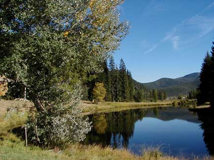
This beautifully landscaped historic site contains buildings built by the Civilian Conservation Corps, a pond, a small arboretum, a creek, and a section of the Mullan Road. Look for swallows, Cinnamon Teal and Mallards at the pond and forest birds along Savenac Creek.
Narrative:

Take a walk through the arboretum where you can walk through the trees and reflect on the names of fallen fire fighters from 1910.


![The memorial plaque which reads, "This stone is in memory of the seventy-eight Forest Service fire fighters who valiantly died in the great forest fire of 1910. This memorial stone was erected in 1941 by company 956, Camp Taft, Civilian Conservation Corps. The memorial was dedicated in 1996 by the [USDA] Forest Service."](http://www.fs.fed.us/r1/lolo/rec-rentals/savenac-info-43b.jpg)
- Contact:
-
- Superior Ranger District
-
P.O. Box 460
- Superior MT 59872
- (406) 822-4233
Facilities: Parking, Picnic sites, Flush toilets, Horseshoe pits, River/Creek Walk, Scenery, Wildflowers, Wildlife
![]()
Take a walk through the arboretum where you can walk through the trees and reflect on the names of fallen fire fighters from 1910.
| | |
| | |
Contact:
Superior Ranger District
P.O. Box 460
Superior MT 59872
(406) 822-4233
The 7.5 minute series USGS topographic maps for that area
| Driveway Peak | ? | ? |
| Saltese |
Haugan SE | De Borgia North |
| Adair | McGee Peak | De Borgia South |
Switch to TerraServer - Topo Map
Switch to TerraServer - Aerial Photo(If Avail.)
Switch to Maptech MapServer
Switch to TopoZone MapServer
Switch to TopoWest Quad MapServer