Site Information
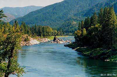
Natural Pier Fishing Access Site
 Classification: FishAccess
Latitude: 47.0149°
Longitude: -114.5066°
Elevation: 3008 ft.
Area: Alberton
Legal Description: T15N,R23W,sec33 MT
UTMZone: 689505, 5209837
Photo:
|

The 7.5 minute series USGS topographic maps for that area
| Horsehead Peak | Stark North | McCormick Peak |
| Tarkio |
Stark South SE | Alberton |
| Williams Peak | Deer Peak | ? |
Switch to TerraServer - Topo Map
Switch to TerraServer - Aerial Photo(If Avail.)
Switch to Maptech MapServer
Switch to TopoZone MapServer
Switch to TopoWest Quad MapServer