Site Information
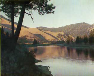
Dry Creek Fishing Access Site
 Classification: FishAccess
Location: I90 exit 43
Latitude: 47.2243°
Longitude: -114.9602°
Elevation: 2814 ft.
Area: Superior
Legal Description: T17N,R26W,sec19 MT
UTMZone: 654424, 5232108
The 7.5 minute series USGS topographic maps for that area
| Saint Regis | Keystone Peak | Quinns Hot Springs |
| Wilson Gulch |
NW Superior | Idaho Gulch |
| Illinois Peak | Landowner Mountain | Lozeau |
Switch to TerraServer - Topo Map
Switch to TerraServer - Aerial Photo(If Avail.)
Switch to Maptech MapServer
Switch to TopoZone MapServer
Switch to TopoWest Quad MapServer